UK Butterflies
Building a Community of Responsible Butterfly Enthusiasts in Britain & Ireland
Building a Community of Responsible Butterfly Enthusiasts in Britain & Ireland
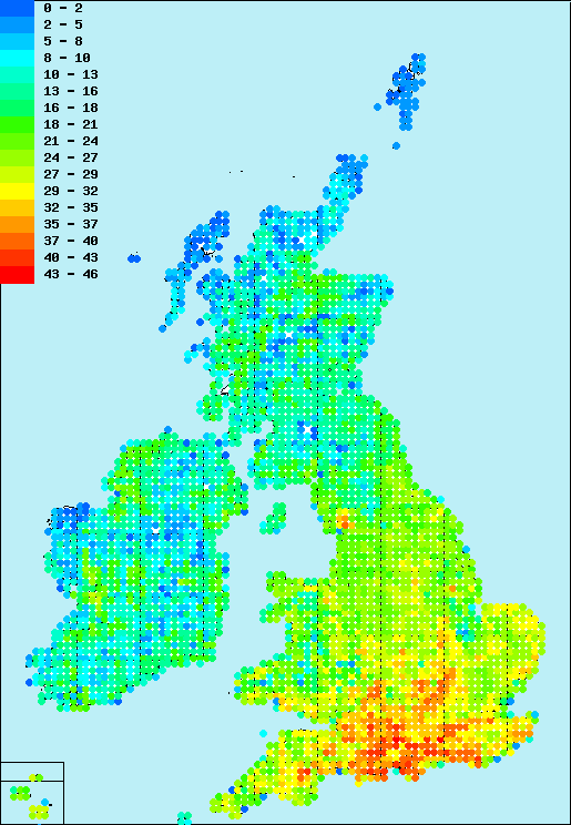
The map below shows the density of species across Britain and Ireland at a resolution of 10km. The distribution data (2000-2009) has been made available through the generosity of Butterfly Conservation. The "top" 10km squares with the most species are:
| Position | Grid Reference | No. Species | Map | Species |
|---|---|---|---|---|
| 1 | SU93 | 45 | Show Map | Show Species |
| 2 | SU23 | 44 | Show Map | Show Species |
| 3 | SZ49 | 43 | Show Map | Show Species |
| 4 | SU81 | 43 | Show Map | Show Species |
To find the species recorded for a given 10km square, select the grid reference using the fields below and click the "Search" button.